Observatory Hill
By Gavin W. Kleespies, 2013
The area called Observatory Hill has its center at the intersection of Concord and Huron avenues and stretches out to include the Harvard Observatory and surrounding areas.
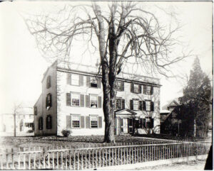
The eastern half of the neighborhood was once a part of the Vassall estate. The first of the family in Cambridge was John Vassall, who purchased an old mansion and about seven acres of land in 1736 to move closer to his father-in-law, Lieutenant Governor Spencer Phips. In 1741, he sold this estate to his brother, Henry Vassall, who added to the house. Although it is unclear how much of the original structure that John Vassall purchased is still standing, the home Henry Vassall lived in remains today at 94 Brattle Street.
In 1759 John Vassall’s son, also named John Vassall, built what is today 105 Brattle Street (the Longfellow House) and began amassing a large estate. At its height, John Vassall’s estate encompassed almost 100 acres from the banks of the Charles to Garden Street. Although it is difficult to be certain about how the land was used, it appears that much of this land was not farmed but served mainly for the entertainment of the family and friends of the Vassalls; it once contained a summer home on top of Observatory Hill. However, John Vassall, like his Brattle Street neighbors, was a Tory, an Anglican, and loyal to the British Crown during the American Revolution. His estate was seized and became the headquarters of General Washington during the Siege of Boston.
After the Revolution, much of this estate was purchased by Andrew Craigie, who built the Canal Bridge (roughly where the Museum of Science is today) and developed East Cambridge before bankruptcy and scandal forced him to live out the end of his days as a recluse.
Just east of Observatory Hill was a free, self-sufficient African American community, known as Lewisville, from the beginning of the 19th century. This settlement was roughly between Concord Avenue, Garden Street, and Shepard Street. Some of the residents were the descendants of people enslaved by the Vassall family, and by the middle of the 19th century, some had become political. In the early 1850s, Adam Lewis joined the abolitionist colony at Dawn, Ontario, and in 1858 Enoch Lewis led a group of 23 members of the Cambridge Liberian Emigrant Association to settle in St. Paul’s River in Liberia.
Garden Street was an early road that was, in part, known as the Way to the Great Swamp. It was later renamed to mark the site of Harvard’s Botanical Gardens, which were tended to by Asa Gray, the famous American botanist and the namesake of Gray Gardens East and West. Concord Avenue was laid out in 1803 as the Concord Turnpike and run as a toll road by the West Boston Bridge Company. The turnpike was designed to funnel traffic toward the bridge (roughly at the site of today’s Longfellow Bridge). The West Boston Bridge Company stopped charging tolls in 1829.
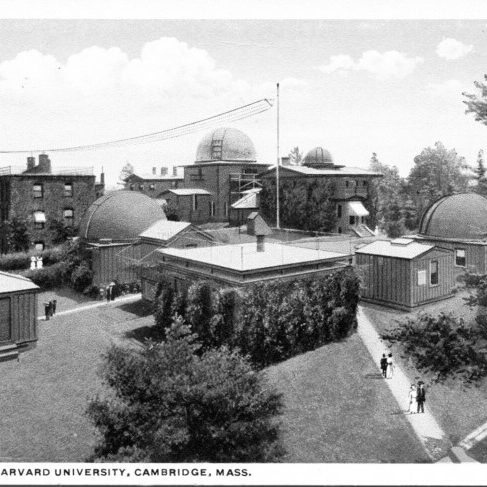
The area remained largely undeveloped until the mid nineteenth century. This began to change when Harvard College purchased farmland in the mid 1840s for its observatory. The first observatory (1843) was designed by Isaiah Rogers, although only a portion of the original structure remains.
