The Huron Avenue Area: Development of a Streetcar Suburb
By Charles M. Sullivan, 2007
Huron Avenue is one of the newest neighborhoods in Cambridge, but it is intimately connected with one of the oldest. It is the sole example of the classic 19th century streetcar suburb in Cambridge, and owes its existence to another neighborhood’s rejection of that mode of transportation.
The development of Huron Avenue was dictated by the physical geography of Cambridge. The original settlement at today’s Harvard Square was bordered by a level plain that extended from Dana Hill to the foot of Avon Hill. A ridge extending from Avon Hill west into Watertown separated the village from Fresh Pond and squeezed the Watertown Road (today’s Brattle Street) on to a level route along the Charles River. The two roads that crossed the ridge, Garden Street and Sparks Street-Vassal Lane, dead-ended in the marshes around Fresh Pond.
The initial settlement of this area consisted of homesteads ranging from a quarter of an acre to eight acres in size along Garden Street and Brattle Street as far as Sparks Street, which was the boundary of Watertown until 1757. Watertown, by contrast with Cambridge, was founded as an agricultural settlement, and west of Sparks Street the land was divided into long, narrow tracts that gave each farmer portions of salt marsh, meadow, south-facing pasture, north-facing slope, and fresh-water wetland. Beginning about 1758, these farms proved attractive to Boston merchants and West Indian planters looking for rural retreats, and their mansions gave the area its nickname, Tory Row.
After the Revolution most of the Tory estates were sold to patriots who continued the luxurious lifestyles of their predecessors. The construction of the Cambridge Railroad, a horse-drawn streetcar line, down Brattle Street in 1856 enhanced the value of the estates by making them more accessible to Boston. Owners began to subdivide their properties, but were not very successful until the 1880s. Even then, only the south-facing slopes found favor with the new homeowners, and the back slope pastures stayed empty because of their remoteness and their less favorable setting.
In September 1889 the city unveiled a plan to open the north-slope pastures to suburban development. A new road, Huron Avenue, would run from Concord Avenue to the Watertown Branch of the Fitchburg Railroad, near Fresh Pond, incorporating the east end of Vassal Lane and a new cross street between Standish Street and Grozier Road. The landowners along the route agreed to grade the new street and to turn it over to the city as a public way.
The development of the back slope was facilitated by the introduction of electric propulsion for streetcars between Harvard Square and Boston in 1889. Early electric cars were extremely noisy, fast, and disruptive, and Brattle Street homeowners mobilized their considerable clout to block the conversion of their line. The Cambridge Aldermen supported the project, but Governor William E. Russell, a Brattle Street resident, blocked it in 1893. Mayor William A. Bancroft, who later became president of the street railway company, worked out a compromise that involved laying tracks on both Mount Auburn Street and Huron Avenue and abandoning the Brattle Street line in 1894. In 1896 the Huron line was extended to Mount Auburn Street by way of Aberdeen Avenue.
The new car line allowed the area to become a classic streetcar suburb. The north slope pastures of the old Lechmere and Lee estates were developed by builders who subdivided large tracts, laid out streets, and built large numbers of nearly identical two-family houses for sale to workingmen. For example, Enos Comeau acquired 57,000 square feet at the corner of Huron and Appleton streets from the heirs of John Brewster, laid out Appleton Road, subdivided the land into twelve lots, and in 1915-16 built six two-family houses ranging in price from $5,000 to $7,000. Similarly, in 1917 builder Jacob Sorkin put up four almost-identical houses on the opposite side of Appleton. Dunstable Road, which was laid out by Cambridge developer Thomas Hadley just below the crest of the hill in 1922, contains six relatively expensive houses and divides the utterly different neighborhoods on the north and south slopes of Reservoir Hill.
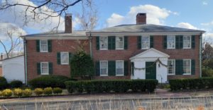
The north end of the old Fayerweather estate, including several clay pits between Huron Avenue and Vassal Lane, had been subdivided for over twenty years when General Edward Hincks bought thirty-five vacant house lots in 1872. In 1892 Hincks built a substantial Colonial Revival house at the northwest corner of Fayerweather and Huron, but it stood alone among the cornfields until well after the opening of the Huron Avenue car line. Gurney Street was laid out in 1904. Although its intersection with Fayerweather was marked by two substantial houses — including 55 Fayerweather Street, which continued the tradition of a formal elevation facing south — the rest of Gurney and Fayerweather down to Huron was filled between 1909 and 1916 with closely spaced, almost identical two-family houses by builder Bernard A. Rice, who broke a covenant to build a community garage that decades later became the Fayerweather School. Blakeslee Street (laid out in 1921) and the rest of Reservoir down to Huron Avenue were also densely built up by 1930.
Other builders filled the streets north of Huron with two-family houses and three-deckers until the neighborhood was substantially complete by the Depression. Today, Reservoir Hill remains the social watershed that divides the wealthy Brattle Street neighborhood from the streetcar suburbs reached by the Huron Avenue trolley line.
